Established 2004

Ruddlesden geotechnical

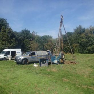
Ruddlesden geotechnical provides ground investigation, geotechnical consultancy and contamination assessment services.

Based in Exeter, but covering the whole of the UK, albeit primarily concentrated in the South West, Ruddlesden geotechnical was formed in 2004.

Ruddlesden geotechnical works on behalf of a wide client base, including local, regional and national housing developers, housing associations, commercial developers, building contractors, structural and civil engineers, architects, building consultants, quantity surveyors, local authorities and private individuals.

Development projects range from single dwellings and extensions to large housing estates, multi-storey flats, offices, industrial units, roads, slopes, schools, hospitals and basements.

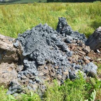
The services and projects listed on this web-site provide an indication of those undertaken by Ruddlesden geotechnical, but others are carried out. If your requirement is not readily identifiable on this web-site, please contact us as we may still be able to help you.

  • AGS
  • Constructionline
  • CSCS
  • SMAS
  • ECFC trust
  • Latest news

    09 Jun 2026

    Mini golf in a Cornish rock garden

    A bit of rain did not dampen the spirits at the Ruddlesden geotechnical golf day this year, when retaining the trophies became the theme of the day.Smashing balls into a field in Cornwall (Trackman driving range) was followed by lunch in the feasting barns, with the main event – mini golf in a Cornish rock garden – in the afternoon. Geoff and Sarah retained their first male and female prizes, Becky put a lot of effort in hanging on to her wooden spoon trophy, and Catherine won the nearest the pin trophy for the first time. As always, there was no winner of the ‘beat-the-boss’ prize, but this year that was only because having the same score does not mean beating!

    Mini golf in a Cornish rock garden
    Mini golf in a Cornish rock garden
  • Recent projects

    P20 Groundwater Risk Assessment Demonstrates No Remediation Required

    At a former engineering works near Exeter, elevated levels of polyaromatic hydrocarbons (PAH) and total petroleum hydrocarbons (TPH) were recorded in both the soil and groundwater beneath the site. As screening criteria had been exceeded in the groundwater beneath the site for these contaminants, further assessment was required to ascertain whether the recorded levels of contaminants beneath the site could migrate to off-site receptors, e.g. to a nearby river, and cause unacceptable levels of pollution to the water environment. Remedial targets were calculated using the Environment Agency’s Remedial Targets Worksheet (P20 assessment). In this instance, the recorded values were below the calculated remedial targets and the risk assessment demonstrated that unacceptable pollution was unlikely to occur to controlled waters, as the levels of contaminants on-site were modelled to have diluted by natural attenuation and dispersion processes before reaching the receptor. No further assessment or remedial works were considered to be necessary. This was agreed with and accepted by the Environment Agency.

    53-controlled-waters-risk-assessment-1
  • Recent projects

    Solution Feature Investigation, Brixham

    A solution feature investigation and assessment was undertaken by Ruddlesden geotechnical at the site of a proposed residential development in Brixham. The consulting engineer had recommended Ruddlesden, having prior experience with solution features (caves) beneath another residential development site within the area. Based on the findings of the Phase 1 geotechnical assessment, the site was considered to be at high risk of being underlain by solution features that could affect the proposed development. A geotechnical investigation, comprising a combination of open-hole rotary ‘probes’ and cored boreholes, was undertaken. The boreholes were targeted on the corners of the proposed plots. The investigation indicated that one of the plots was underlain by a substantial cave (up to 5m high), at a depth of less than 10m below existing ground level. The cave appeared to be filled with sediment and the overlying rock had dilated and partially collapsed into the cave as a result of its presence. Nevertheless, following a detailed assessment of the ground conditions encountered, it was considered that there was a sufficient thickness of competent limestone present to bridge the cave and that a reinforced concrete ground beam would be able to support the proposed property (even in the event of ground subsidence) and that there was no requirement for infilling of the solution feature or piling the foundations to competent rock beneath the cave.

    32-brixham-reduced-3